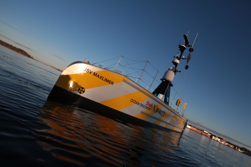
The winners of the latest XPRIZE competition were announced on Friday. Sponsored by Shell with a bonus prize from the US National Oceanic and Atmospheric Administration (NOAA), the competition focused on the challenge of exploring the seafloor and saw 32 teams from around the world competing for $7 million.
The primary goal was to build an autonomous, high-resolution seafloor-mapping system that could be launched from a similarly uncrewed boat. Seafloor mapping is incredibly expensive, which limits its use. If the research vessel and extensive crew weren’t necessary, a lot more work could get done with the current amount of funding.
XPRIZE's competition overview.
Nine finalist teams split $1 million last year before the final rounds of testing. Each team took its creations to Kalamata, Greece (an audible after hurricanes scrambled the initial plan to work in Puerto Rico), where they had 24 hours to map 250 square kilometers of seafloor at least 5m resolution. The teams’ maps were checked against an existing, high-quality one.
Separately, four teams tried for NOAA’s $1 million bonus prize. In this test—which was able to be done at Ponce, Puerto Rico—their underwater drone was supposed to detect a chemical signal and track it back to the device responsible. The idea here was to do something like locate a shipwreck or a natural methane seep. No team managed it within the time limit, so the best two efforts split the purse.
The biggest share—$800,000—went to the “Ocean Quest” team of junior high and high school students from San Jose, Calif. Second place went to a Florida group named “Tampa Deep Sea Xplorers“.
The overall competition winner, taking home the grand prize of $4 million, was the “GEBCO-NF Alumni” team. This international team, led by Rochelle Wigley and Yulia Zarayskaya, was composed of people who had completed an ocean-mapping training program at the University of New Hampshire. Their design used as many currently available components as possible, including a floating platform called a “SEA-KIT” with a conveyer-belt-like system for dumping the drone in the water and hoisting it back out when it returns.
The second-place prize of $1 million went to the Japanese team “Kuroshio,” composed of researchers and industry professionals led by Takeshi Nakatani. Team members used a more custom-built boat on the surface together with drones they were already working with. Like the GEBCO-NF team’s system, their surface platform communicated with a data and control setup on land using a satellite link.
An extra “moonshot” prize of $200,000 went to the UK’s “Team Tao.” While the team was unable to complete the challenges while meeting all the requirements, its design was interesting and unusual enough that the judges wanted to reward it. Team Tao was aiming for what its members described as a “CubeSat-like philosophy.” Their catamaran-style surface vessel could carry many smaller drones, which themselves are a little less conventional in that they maintain a vertical orientation while swimming around. The design includes an airborne drone flying overhead, as well.
Although the competition has come to an end, XPRIZE also announced a continuing partnership with the SeaBed 2030 Project, which is aiming to produce a publicly available map of the entire seafloor by 2030. The project was launched in 2017 and already has the backing of a range of organizations including the United Nations and the General Bathymetric Chart of the Oceans (GEBCO) program that leads the University of New Hampshire training program responsible for the winning XPRIZE team.
Không có nhận xét nào:
Đăng nhận xét